Hayduke Trail: What You Need To Know
If you’ve thru-hiked enough trails, the Hayduke Trail will eventually land on your list. You’ve got great navigation skills and you’re ready for an adventure of a lifetime!
Based on a character in “The Monkey Wrench Gang,” the Hayduke Trail gives you an understanding of the American Southwest like no other trail.
You’ll see the unknown sides of national parks, scramble down into canyons on questionable sheep paths, you’ll get to know exposure better than ever – does this appeal to you? Here, you’ll find out what you need to know before attempting a thru-hike of this route.
My partner and I thru-hiked the Hayduke Trail in 2017 and it’s one I remember vividly. I remember the sheer terror of walking on narrow ledges with 1,000ft of exposure, finding a descent uncomfortably loose, searching for the least alkaline water, and so much more.
If you have the skills to thru-hike the Hayduke or want to learn what skills to gain, read on!
This post contains affiliate links. I have used every product mentioned and if you purchase one of these products I can make a small commission at no cost to you.
List of Contents
Why You Should Take the Hayduke Trail Seriously

The sense of adventure on the Hayduke Trail is REAL.
However, so is the danger and the potential harm to the landscape.
You should take the Hayduke Trail thru-hike seriously because you’ll discover a whole new level of exposure. You’ll scramble frequently with the potential for large falls or loose rock.
Basically, you need to know your shit and have the experience to back it up. You’ll also see footprints made in cryptobiotic soil made probably a decade ago. While the large black crusty lumps don’t seem like much, they’re actually teaming with life. Damage to them can take years to decades to recover.
The Hayduke “Trail” a crazy route that brings you to very remote places in the desert with limited water, high risks, and a delicate landscape.
Do this trail at your own risk!
Not sure if you’re ready for the difficulty of the Hayduke Trail? Read my post on the AZT vs GET vs HDT!
Hayduke Trail Map

While the starting point for the Hayduke Trail is in Arches National Park and the ending point is in Zion National Park, you will not hike a straight line to get there.
➡️ The Hayduke Trail IS NOT direct. It meanders. It follows rivers, canyons, natural shelves in the landcape, and it explores.
I remember in a single day on the Hayduke, Karma and I hiked down into one canyon until it converged with another. By the end of the day, we made it to the top of the second canyon.
We had a Garmin InReach and had sent texts to our parents of where we camped. We got a text back laughing that we had only gone 5 miles by the bird’s eye view from our last camp spot.
However, we had actually scrambled and bushwhacked 15 miles with packs full of water. We weren’t supposed to have any water in that stretch, so we had a day and a half of water on our backs.
🏜️ Remember: just because you’re not going fast in one direction, it’s about exploring the landscape on a deeper level.
Why is it called the Hayduke Trail? Who is Hayduke?
The Hayduke Trail is named after George Washington Hayduke III, a character in Edward Abbey’s “The Monkey Wrench Gang.” Joe Mitchell and Mike Coronella created the route.
Yes, an entire route is named after a fictional character.
George Washington Hayduke III is a Vietnam veteran who returned from the war to the Utah and Arizona. However, development, industry, and capitalism had started to change the landscape he loved.
He measured distances he drove with 6-packs of beer, winched himself and his jeep out of entertaining situations, and he’s an all-around hell-raiser.
While the Hayduke Trail namesake is not one to look up to per se, he makes some fascinating points. The same goes for Edward Abbey himself, even though he modeled Hayduke after a friend of his.
Before you hike the route, I highly recommend reading both “The Monkey Wrench Gang” and “Hayduke Lives.” They will both help you understand the route and the landscape better.
Hayduke Trail Length
The Hayduke Trail is roughly 800 miles.
Your exact hike mileage will depend on how much you stick to the original route. Now, you have the option to take dozens of alternates.
And that’s the beauty of it…a route means you can pick the original route or an alternate, and you’ll always have an adventure.
When You Should Hike the Hayduke

You should hike the Hayduke, much like the Arizona Trail and the Grand Enchantment Trail in the spring or fall.
🌸 In the spring, you could start in Arches National Park somewhere between March 15 – April 15. Exactly when depends on your schedule and the winter snowpack.
If you start in Zion National Park in the spring, you should start later. However, expect the end of your hike in Arches to get HOT.
Traditionally, you would go westbound in the spring (Arches to Zion).
🍂 In the fall, you could start in Arches or Zion circa Sept 5-20 westbound. A benefit to go east would be to do the North Rim of the Grand Canyon earlier in the fall. Still, you’ll have the Henry Mountains in the east, but alternates exist.
Most people go westbound, even in the fall, because of how the route is written. While there is a Hayduke GPX track, it’s more of a guideline, and you’ll want descriptions.
What’s the Weather like on the Hayduke Trail?

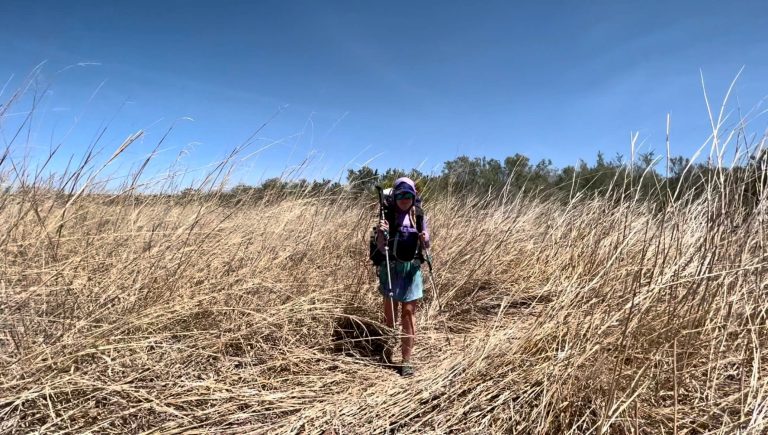
Karma and I hiked in the spring of 2017, and overall, we had hot weather. 🥵 Due to ski season jobs, we couldn’t start until April 13th in Arches National Park. Thus, we started at the later end of the recommended window.
We had four friends start a week prior (April 6th), and they had much cooler weather.
That being said, a week or two can make a HUGE difference in the weather you’ll experience on the Hayduke.
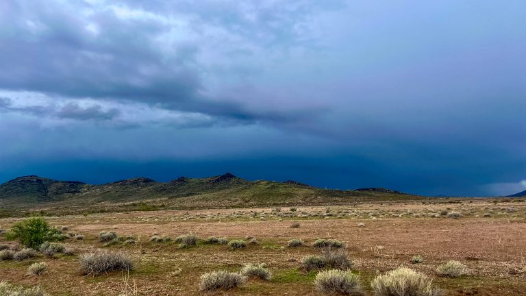
The elevation varies drastically on the Hayduke from 1,800ft to 11,419ft. Generally speaking, the lower the elevation, the warmer it will be.
We even had snow on the Kaibab Plateau in mid-May, pictured above. ❄️
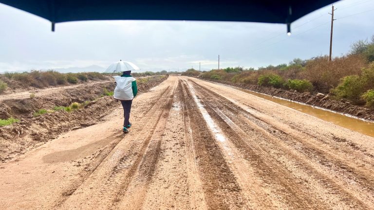
In either case, you should definitely prepare for the wind. 💨 Make sure you have good strategies for securing your shelter stakes and keeping all your gear in the right place. It will batter you and get sand all up in your food.
How Hard is the Hayduke “Trail” Really?

A Hayduke Trail thru-hike is very difficult. Even if your navigation skills are strong, you’ll get lost, make a wrong turn, have to back-scramble to a different drop-in, and more.
You will have larger water carries than most other trails.
You will scramble up and down over loose rock.
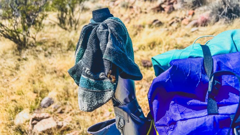
Sand will get into everything! Your food, your gear, your teeth will feel the small crunch of sand.
The wind will batter you. It will throw sand and dirt under your shelter. You’ll have to find less windy spots to camp. 💨 ⛺️
Resupply towns are few and far between. What they have in them is limited. Getting to them can be down miles and miles of dirt roads. We made food caches to avoid the hardest hitches.
You’ll face exposure almost every day. Constantly, you will think through your risk management.
You’ll find yourself searching for the least alkaline water you can get. 💦
It will test you. A Hayduke Trail thru-hike is NOT a beginner hike or even an intermediate hike.
You must be able to navigate off-trail using both paper maps and Gaia GPS through difficult terrain.
⬇️ Want to up your off-trail navigation skills? Check out this post ⬇️
What National Parks You’ll Hike Through on the Hayduke
The Hayduke “Trail” goes through 6 National Parks. Moreover, it usually takes you to places in those parks that are hardly visited.
Depending on the park and the in-route options you take, you may or may not need permits. It’s always best to check the Hayduke Trail Facebook Group for the most recent permit updates.
IMPORTANT: DO NOT be fooled at the difficulty level. This route takes you through parts of these parks that see VERY FEW people. You do not (hardy) get cushy National Park trails that you’re thinking of.
Arches National Park

Arches National Park is the start for most Hayduke Trail thru-hikes. In true Hayduke fashion, you’ll start on a sandy 4WD road at the northern end of the park.
You’ll get some of your first tastes of cryptobiotic soil, slick rock, and navigating in Utah.
📝 You can get a backcountry permit ahead of time since you’re starting, however, most people use a loophole.
About 10 miles into the hike, you come close to the western park boundary. You can hop the barbed wire fence and camp on the other side which is BLM land. Then, you just have to push a longer day into Moab and stay at the Lazy Lizard Hostel.
Canyonlands National Park

Canyonlands National Park on one route can be done in a single day if you sleep at Needle’s Outpost the night before.
Because the Hayduke is a route, not a trail, feel free to take any of the park trails through it. We chose to add the Joint Trail slot canyon to our hike through Chester Park.
Capital Reef National Park

Capital Reef National Park has very beautiful rock formations and wide canyons. The Hayduke Trail will keep you well away from any crowds.
📝 Here, you may need to call in a permit from Hanksville, Utah. The only part of the thru-hike through Capital Reef that crosses people is near the Burr Switchbacks. Nearby, a backcountry ranger station sits with a ranger who’s onto Haydukers.
The park mostly wants to tell you to leave no trace, don’t touch archaeological ruins, and stay off cryptobiotic soil.
I will always remember the “uncomfortably loose” decent into Middle Moody Canyon leaving Capital Reef.
Bryce Canyon National Park

Bryce Canyon National Park has more crows than you’ve experienced yet. The Hayduke Trail goes through in one day easily.
However, if you’re craving more, you can add an extra few miles.
I believe one of the overlooks even had Verizon signal.
Grand Canyon National Park

You’ll never see Grand Canyon National Park the same after your Hayduke Trail thru-hike.
While the Hayduke uses the main corridor in the Grand Canyon, it does SO. MUCH. MORE.
This permit, we got well in advance months before we started hiking.
HOW WE FIGURED OUT THE PERMIT: We knew our start date. Then, we calculated 15-mile days from that start date until we’d hit the Nankoweap Trail. We placed that as our start date. With a National Geographic map of the Grand Canyon, you can see the “backcountry zone” codes to plan your campsites.
We also planned 15-mile days through the Grand Canyon, figuring we’d want to take tons of breaks. BUT, I wish we had planned 10-12 mile days instead. Yes, that little.
The trails and routes within Grand Canyon National Park on the Hayduke “Trail” are HARD. And, BEAUTIFUL. I wanted more time.
IMPORTANT HELPFUL NOTE: If you are within the dates of your permit, but off by a day or two, go to the backcountry office on the South Rim. They can adjust your permit as long as your still in the dated window. However, if you’ve totally missed your permit, they can’t do anything except issue you a new permit IF any are available.
Zion National Park

Last, but certainly not least, is Zion National Park. In true Hayduke fashion, you’ll enter in a completely odd way along the East Fork of the Virgin River.
From there, you can make your way into the park and out in one long day. Or, you can hop the barbed wire fence when you get close to the boundary and sleep outside of the park.
While the Weeping Rock trail from the shuttle bus has opened again, the East Rim Trail (which the Hayduke uses) has not.
Thus, you’ll have to get creative and make your own end to your Hayduke “Trail” thru-hike.
Hitching Across the Colorado River in the Grand Canyon

Picture this: you’ll hike down the Nankoweap Trail into the Grand Canyon. This is the hardest-named trail in Grand Canyon National Park.
Then, you’ll cross-country and bushwhack through some invasive tamarisk to a gps point on a “beach.”
Finally, you’ll stick your thumb out and hitchhike across the Colorado River to the other side on a raft.
This experience was definitely in my top 5 hitchhiking experiences EVER.
THE TRICK? Rafts and boats go by this spot on most days between about 9 am and 2:30 pm. If you get there after that, you’ll be sleeping on that beach until a boat comes by in the morning.
Lastly, this stretch of river is very calm and quiet. Once a boat comes near, you can actually talk to the rafters easily and tell them you just need a ride across to the other side!
Important! Leave No Trace on the Hayduke Trail

While you should practice Leave No Trace on every trail, you should be on your shit on the Hayduke Trail.
For example, in the best conditions, toilet paper takes about 2 years to decompose. That’s in wet, forested areas like the Appalachian Trail. In the desert, it takes far longer. Pack out your toilet paper!
Furthermore, learn about cryptobiotic soil before you go. Once you realize its importance in the high desert, you’ll be more likely to protect it by rock hoping.
The land that the Hayduke “Trail” passes through needs all the help it can get and that starts with us.
Final Thoughts
A Hayduke Trail thru-hike is no joke. It tested every backpacking, thru-hiking, and outdoors skill we had.
If you have the experience, off-trail navigation skills, and knowledge of the desert, it is a beyond amazing experience. You will still hurt, wonder what the hell you’re doing, get squirrely, and probably leave some blood on the route.
Know how to manage risk and assess it constantly. Think: if I slide down this and I’m wrong…can I get back out? Think: if I fall here, will I be able to get myself out or will I need to rely on technology and rescuers? Be real with those thoughts and sit with them.
Please, protect this route. Please, respect it. And, please, do your research before you go out.
➡️ If the Hayduke is too much right now, build your skills on the Arizona Trail or the Grand Enchantment Trail first.