
Arizona Trail Thru-Hike: The Complete Guide (With Gear List)
An Arizona Trail thru-hike should definitely go on your list! The Arizona Trail runs 800 miles from the Mexico/Arizona border to the Arizona/Utah Border through cactus-filled valleys, mountain ranges, high desert, and Grand Canyon National Park.
You’re either looking at the Arizona Trail because you’re a first time thru-hiker OR because you need a thru-hike fix, but can’t hike a longer one. Either way, an Arizona Trail thru-hike crams all the good stuff in without a lot of fluff.
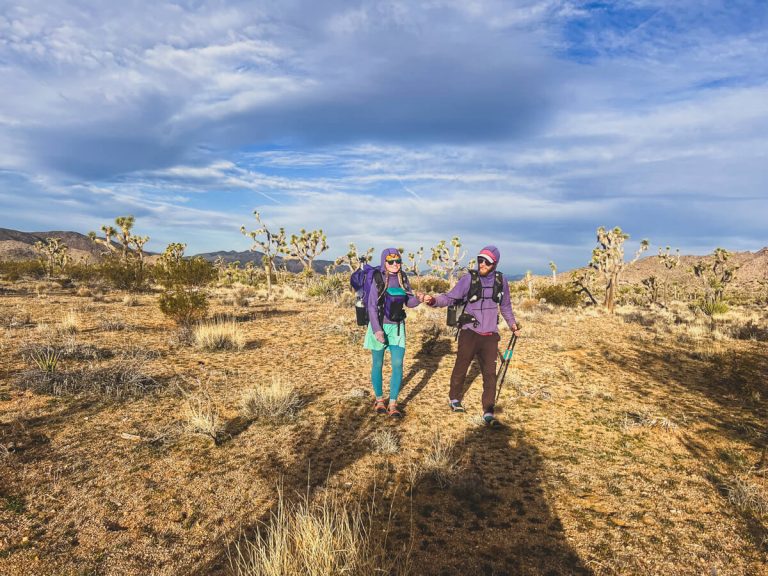
I’ve thru-hiked the AZT once, and my partner, Karma, has thru-hiked it twice. We LOVE it and you will, too. In this complete guide, you’ll learn about the best time to hike, the difficulty level, navigation, water sources, and there’s a bonus gear list for your Arizona Trail thru-hike.
This post contains affiliate links. If you purchase a product or book through these links, I can make a small commission at no cost to you. It helps me to keep writing helpful guides.
List of Contents
Best Time to Thru-Hike the Arizona Trail

Located in the heart of the American Southwest, the Arizona Trail shines in the spring and fall.
🌱 On one hand, a spring thru-hike lends to a northbound (nobo) direction.
- The southern portion of trail is overall lower desert and can be done earlier.
- You’ll follow the weather and get through the hotter portion earlier before summer begins.
🍁 On the other hand, a fall thru-hike lends to a southbound (sobo) direction.
- The northern portion starts on the Kaibab Plateau, which sees snow late into the spring and early in the fall.
- You’ll follow the weather and get lower in overall elevation before winter begins.
How Long is the Arizona Trail?

🥾 The Arizona Trail is 800 miles.
Technically, according to Far Out Guides, it’s 799.6 miles. I’m sure you can add an extra .4 miles in there somewhere, going off-trail for extra water. Heck, you’ll probably add way more than that!
Arizona Trail Map

📍 Here is an overview map for your Arizona Trail thru-hike.
Primarily, it runs a central line going south/north through the state.
Arizona Trail Difficulty

Overall difficulty: Moderate.
Why moderate? There are several reasons I’d say an Arizona Trail thru-hike is moderate.
⛺️ First, coming in at 800 miles, it’s not as long as the big three that make up the Triple Crown. However, it’s still 800 miles…
⛰️ Second, it’s a common misconception that the desert is flat. The AZT has a surprising number of mountain ranges it goes up and over. **This is why you can’t start a northbound Arizona Trail thru-hike too early.
💦 Third, you must worry about water. If you have never carried 10-15 miles of water, it’s more weight than you think. I wrote a whole post about water on the Grand Enchantment Trail, and most of that applies to the Arizona Trail as well. You can find that here.
📄 Fourth, you need to deal with two different permits for each of the national parks. Any thru-hike that involves permits adds a level of bureaucratic difficulty.
🥵 🥶 Fifth, you’ll deal with both heat and cold temperatures. This means you’ll have to have gear that you can stay cool in and keep warm.
➡️ Lastly, I’d place the Arizona Trail difficulty level at moderate because of the length, number of climbs, water carries, temperature, and permits combined.
⬇️ Looking for something more difficult? ⬇️
National Parks on Your Arizona Trail Thru-Hike & Permits
You get to hike through 2 national parks on your Arizona Trail thru-hike. YAY! 🥳
Both Saguaro National Park and Grand Canyon National Park represent some of the best areas in Arizona.
⚠️ However, you do have to pay attention because they need permits. ⚠️
Saguaro National Park

Saguaro National Park has two separate parks in one – the east and west portions. You’ll hike through the less-used eastern section.
📄 You DO need a permit! Even if you don’t plan on camping, you must pay for a day pass!
You can get a permit online here. If you forget, there is cell reception (at least for Verizon) at the SNP southern border going northbound. You can call in a permit over the phone. 📲
Rangers are getting serious about permits and beginning to fine those without.
🌵 On your Arizona Trail thru-hike you’ll travel through 17.7 miles of Saguaro National Park.
While the mileage doesn’t seem to be too hard, it goes up and over Mica Mountain.
If you’re hiking in early spring, Mica Mountain MAY have snow still. When we started in mid-February, we post-holed the entire way up and over Mica Mountain.
Grand Canyon National Park

Grand Canyon National Park will be a highlight of your Arizona Trail thru-hike.
🥾 You get to spend 39.1 glorious miles hiking down into it (and back out the other side!)
📄 And YES, YOU NEED A PERMIT.
However, you may enter Grand Canyon National Park for day hiking without a permit. You will hike a few miles and head straight to the backcountry office on either the south or north rim.
Remember – those rangers are swamped and dealing with all walks of humanity. Be kind to them and be flexible.
⛺️ Your GCNP permits depend on availability and how many other AZT thru-hikers are there as well. If you can’t get the permits you want, ask to take a zero in the hiker/biker section of the car campground.
After, you will hike through the main corridor of the Grand Canyon! These trails are both the most maintained and the most traveled.
You’ll be amazed at what you see beneath the rim. For starters, the colors change drastically as you change elevation. Moreover, you’ll see an entire sunken mountain range within the canyon itself. Do yourself a favor here and slow down to enjoy it. 🌄
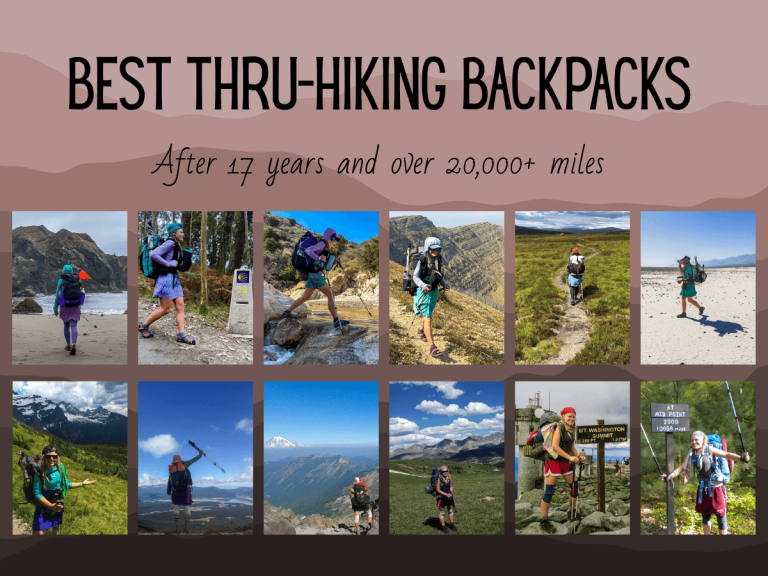
Arizona Trail Thru-Hike Gear List

Below is a list of gear you can use to help plan your Arizona Trail thru-hike.
Big Three:
- 🎒 Backpack: Aim for a pack that’s ideally around 2.5 lbs or less AND sturdy enough for water carries. I currently use the Six Moon Designs Swift X with a Vest Harness.
- Why I recommend it: The flight harness acts as a running vest and makes your often needed items super handy. Also, You can easily load it up with water if needed and cinch it up if you don’t.
- ⛺️ Shelter: Aim for a shelter that is 2.5 lbs or less for 2-people or less than 2 lbs for 1-person. We currently use the Six Moon Designs Haven Bundle.
- Why I recommend it: Because on warm desert nights, we like to sleep with just the bug net.
- 😴 Sleeping Bag/Quilt: Aim for 2 lbs or less. We currently use Jacks’R’Better Sierra Sniveller Couple Quilts.
- Why I recommend it: The quilts come together in the evening, and we can separate them during the day. Hint: Ask for the omni-tape!
Other Key Items
- 🥱 Sleeping Pad: This is a matter of preference. I don’t sleep well on closed-cell foam pads. I recommend the Women’s Neo Air.
- Why I recommend it: If you’re careful you can make it last a long time. I got my first one to last 8 years (and patched 6 holes).
- 💦 Water System: Sawyer Squeeze! (**NOT the mini…that will clog so fast on the AZT)
- Why I recommend it: It’s light and easy to maintain. I write more about why it’s the best water filter in my post about water on the Grand Enchantment Trail.
- 🍳 Cook System (Cold Soak or Stove): We use the Windmaster Soto stove, Trek titanium pot, titanium spoons, & the 4oz isobutane canister fuel.
- Why I recommend it: Cold soaking is miserable. One hot meal per day makes a difference in overall well-being.
- ☂️ Ultralight Umbrella: We use the Six Moon Designs Silver Shadow.
- Why I recommend it: It’s seriously 5-10 degrees cooler under it. It also makes me not mind the rain.
- 🧢 Clothing: Layering System for the Desert: Check out temperatures in the lowlands near places like Vail or Kearney, Arizona, and higher places like Mount Lemmon or the North Rim of the Grand Canyon. Bring a layering system that works for both. Don’t forget rain gear!
- 💊 Medical Kit: You really do need a basic medical kit with tweezers!
- Why I recommend it: You will inevitably, accidentally have a bad encounter with a cactus on the Arizona Trail. Do yourself a favor and have tweezers for all the small spines.
- 🔌 Battery Pack & Charging System: You’ll want Battery Pack(s), a block, and charging cords for all your devices.
Mountain Ranges on the AZT

While a wide open desert exists in Arizona, it also hosts a surprising number of mountain ranges.
Your Arizona Trail thru-hike will take you up to the top of many mountain ranges. However, on a few, you climb into them, but not summit them.
Let’s take a look:
- Huachuca Mountains – You’ll waste no time in the beginning by climbing Miller peak.
- Santa Rita Mountains – After Miller Peak kicks your butt, you get to mostly hang out next to the Santa Rita Mountains. You do go over a steep pass though.
- Rincon Mountains – You’re break is over and you’re climbing up Mica Mountain!
- Santa Catalina Mountains – Mount Lemmon is no joke either. Another big mountain to climb up and over. But, it does have beautiful views.
- Superstition Mountains – These beautiful peaks overlook Phoenix.
- Four Peaks – A few more climbs will offer great views of Roosevelt Lake.
- Mazatzal Mountains – Enjoy a large wilderness area with fantastic views, and you guessed it…a few big climbs!
- Mogollon Rim – While the Mogollon Rim isn’t a mountain range, it is a significant geographical feature. It represents your climb out of the low desert and onto the Colorado Plateau
- San Francisco Peaks – Leaving Flagstaff, you’ll go quite a ways onto the side of the San Francisco Peaks and contour toward Grand Canyon National Park.
Arizona Trail Thru-Hike Navigation

Navigation overall on an Arizona Trail thru-hike is easy. However, you do still have to pay attention.
1️⃣ First, the Arizona Trail Association kindly maintains wonderful single-track trail for the grand majority of your 800-mile jaunt. Thus, stay on trail.
2️⃣ Second, you can pay for the AZT on Far Out Guides. Far Out navigation is about as easy as it gets…follow the red line, read the comments, and make appropriate decisions. They now offer a subscription, but I still prefer to purchase each trail outright to re-hike it or provide trail magic later!
Basically, if you can stay on trail and keep your phone charged, you’ll likely not have too many issues.
The Arizona Trail is the perfect introduction to desert hiking. If you’ve already done a lot of desert hiking and are looking to challenge your navigation skills, check out my 5 tips to build your off-trail navigation skills!
Gateway Communities and Arizona Trail Thru-Hike Resupply

A “gateway community” is a town that understands Arizona Trail thru-hikers.
For example, a gateway community is located on or near the AZT. It has a grocery store of some sort, accommodation of some sort, and usually a restaurant of some sort.
It helps to know ahead of time what each town offers because some have more to offer than others.
If you’re hiking into a gateway community and you’re in a large bubble of hikers, supplies and space can run thin.
It’s best to formulate a plan ahead of your Arizona Trail thru-hike for your resupply.
⬇️ Plan ahead with my guide to buying as you go on the AZT ⬇️
Arizona Trail Start & Finish Transportation Options
Both the start and finish are relatively easy to reach by roads, but not public transportation.
Southern Terminus

Getting to the southern terminus is easiest from Tucson, Arizona
For one, you could go through the list of shuttles provided by the Arizona Trail Association. However, they’re likely to be expensive unless you can get a group together on the AZT Facebook page to split the cost.
🛜 Another way is to post to Craigslist or Facebook Marketplace asking for a ride share.
🚗 You could mine your friends and family for contacts in the area to give you a ride.
🚌 Or, you could get a Greyhound out toward Benson, Arizona, and hitchhike the rest of the way.
Leaving from the southern terminus
If you can plan your finish date far enough in advance, schedule a ride. You could schedule a shuttle, a friend, or an acquaintance to pick you up from Coronado National Monument.
Otherwise, you could hitchhike! Even if you can’t get all the way to Tucson, you’ll likely get to a spot where you can get a Greyhound on i10.
Northern Terminus

Getting from the northern terminus
Once you get to Stateline Campground, you can have a ride scheduled to take you out.
For another option, you could hitchhike out! Karma and I hitched out to Page, Arizona, with little difficulty. It took 2 rides, but we got both relatively fast.
Once you get to highway 89, you could go east to Page, Arizona, or west to Kanab, Utah (and then probably onto St. George, Utah.
Getting to the northern terminus
If you can, have someone drive you there.
Best recommendation (if you have no one to drive you): Fly to Flagstaff. Then, shuttle, hitch, or rent a car one-way to Page, AZ. Hire a shuttle or hitch from Page, AZ, to Stateline Campground.
Your other option would be to go through the St. George, Utah, airport or the Las Vegas, Nevada, airport. Thus, you would need to rent a one-way car to Page, AZ. Then, you could hire a shuttle or hitch.
Both Page, AZ, and St. George, Utah, have airports. However, the Page, AZ airport is very small and somewhat unreliable.
Final Thoughts

An Arizona Trail thru-hike is perfect for two main types of people.
1️⃣ First, it’s a great thru-hike to start on if you’re a beginner. At only 800 miles, it seems more approachable. Moreover, it jam-packs a lot of punch in awesome views, national parks, and not super long resupply options.
2️⃣ Second, it’s a great thru-hike for a seasoned thru-hiker who maybe doesn’t have a ton of time and/or money. You can get your thru-hiking fix on this trail and not break the bank.
3️⃣ However, if you’re a seasoned hiker and you’re looking for a harder trail or challenge go look at my Ultimate Guide for the Grand Enchantment Trail.
In the end, I love the Arizona Trail. I highly recommend it for most people. Please, do your research, make sure you’re ready for desert hiking, and have enough skills to start this amazing adventure!


One Comment
Comments are closed.