
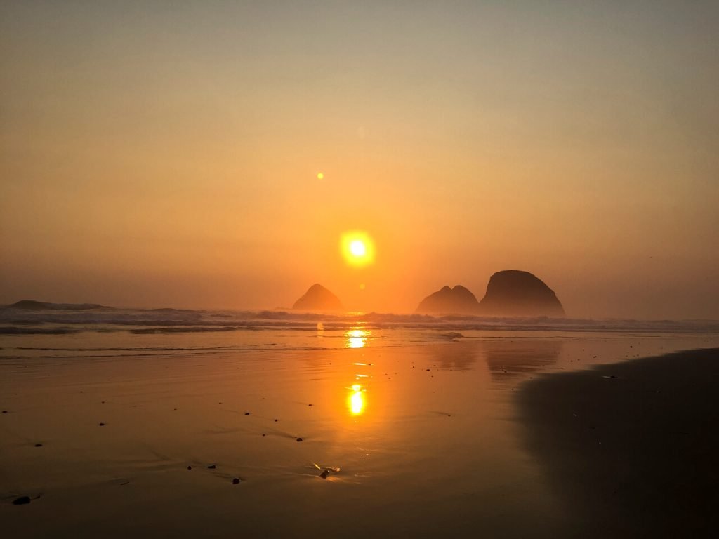
Did you know that the ENTIRE Oregon Coastline has public access? The Oregon Coast Trail takes advantage of the public beaches to create a stunning 400-mile thru-hike!
My partner and I have thru-hiked the Oregon Coast Trail TWICE southbound in 2017 and in 2025. We went in July and August to get the lowest of low tides and the best of berry season.
The Oregon Coast Trail has a different vibe than most thru-hikes in the United States. It’s helpful to switch your mindset before embarking on this trail. These 10 tips are designed to help you do just that.
The OCT has changed between 2017 and 2025, and this post contains all the newest information from our 2025 thru-hike.
If you love walking the beach, looking at tide pools, and watching osprey, pelicans, and puffins, read more about the Oregon Coast Trail below!
This post contains affiliate links. If you purchase a product or book through these links, I can make a small commission at no cost to you. It helps me to keep writing helpful guides.
List of Contents
Oregon Coast Trail FAQ


Before we dive into the 10 best tips for the OCT, here’s an FAQ section to answer all those quick questions.
Where does the Oregon Coast Trail Start and End?
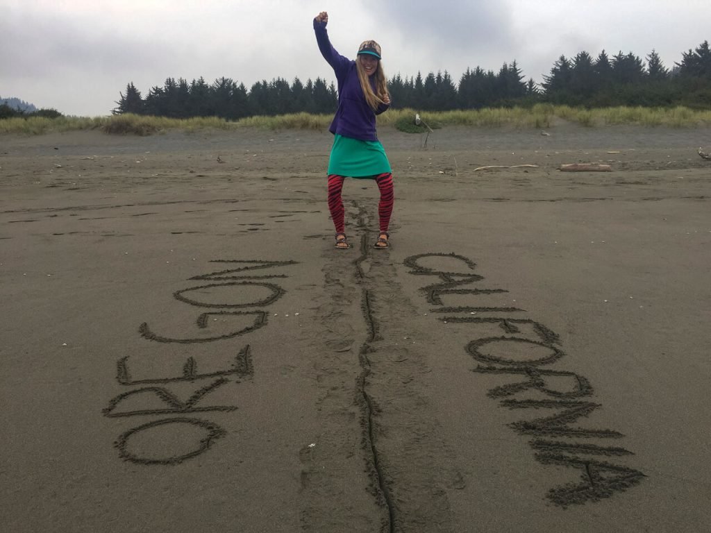
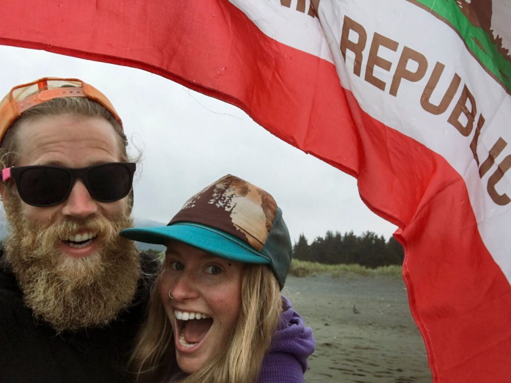
The start and end of the trail are in Fort Stevens State Park (on the Columbia River) and Crissey Field State Recreation Site (the OR/CA border).
Which direction is better for the OCT?
SOUTHBOUND. During the summer and fall, the overall wind direction comes from Alaska south down the western seaboard (including the Oregon Coast). 💨 Thus, if you go southbound, the wind will be at your back.
How often can you resupply?
Often! In the northern third of the Oregon Coast Trail, you can find resupply options every day to every other day. 🌯
Next, in the middle third, you can find options every 1-3 days. 🍜
Finally, in the southern third, you can find resupply every 2-3 days. 🍫
*You can make these times shorter by using the fairly priced local bus system to get food in nearby towns if you need it. Each county has its own local bus system, which is very reliable AND affordable.
There’s too much snow on the PCT…can you do the Oregon Coast Trail while you wait for the snow to melt?
Yes, this is becoming more and more popular. However, I would still go southbound. Just because you’re going northbound on the PCT doesn’t mean you need to go northbound on the OCT. The Oregon Coast Trail is a great way to keep your body moving while waiting for the snow to melt instead of losing your trail legs completely on a couch somewhere.
Can you camp anywhere on the beach?
No. You can camp on the beach 1/4 mile from any town, state park, county park, or state wayside. Plus, between March 15 and September 15, there are large swaths of beach that you can’t camp on so snowy plovers can nest. You can walk by on the wet sand, though. Don’t worry, I made a guide for you!
10 Tips for Thru-Hiking the Oregon Coast Trail

The Oregon Coast Trail has a different vibe.
I found that I adopted more of a Camino mindset for this trail. It’s very town-heavy for only 400 miles. You’re walking through small beach towns and are generally in the public eye much more than other US thru-hikes. If you’re looking for a more remote summer trail, I recommend the Pacific Northwest Trail instead.
While you’re on the beach as much as possible, you’ll also go into the forested headlands. If there is no beach option, usually due to impassable cliffs, and there are no forested trails, you will have to walk roads to get back to the beach.
1. The Oregon Coast Trail is a SOUTHBOUND trail

Because of the summer wind pattern in the Pacific Ocean, the wind comes from Alaska down the coastline to California. 💨
That means that if you hike southbound, the wind will be at your back.
In contrast, if you hike northbound, you’ll hike straight into the wind the whole trail.
That being said, you can hike northbound. However, I personally would not in the summer.
Remember that you’re walking on a beach. So, if the wind picks up (like it does frequently), it will pick up the sand as well. Getting pelted in the face for days on end with sand is enough to make most people switch directions.
Since its addition to Far Out Guides, thru-hikers have started hiking it whenever they get stir crazy outside of the prime season.
If you’re one of those adventurous humans, the winds shift around November/December to go from south to north, thus making it advantageous to go northbound. However, please note that you will likely get max wind speeds of 35 mph in the summer and 65 mph in the winter. The shift back to summer wind patterns seems to occur sometime around May or so.
2. Get a Tide Chart App


You will definitely want a tide chart app for the Oregon Coast Trail! 🌊
I use and recommend Tide Alert by NOAA (free trial), Tides Near Me (free with ads), or Tide Charts (free with ads).
You’ll need this because:
- Some of the beaches can only be hiked at low tide. If you miss this window, you will need to camp beforehand, wait for low tide, or, if possible, get up to 101 and road walk.
- You need to ford several small rivers that end in the Pacific Ocean. Thus, they are subject to the tides. At low tide, they are usually very manageable and only knee-deep. At high tide, they are often waist-deep and strong.
To find the tides for the Oregon Coast on Tide Now:
📍 Go to Location and select Oregon -> the general region of Oregon you’re in -> select the nearest town. If you’re unsure, click “show on map.”
*You will need to adjust this during your hike as you pass new towns.*
Then, you go to “Tide Report” and you can find the high and low tides for each day. 🦀
In the summer, you will get the lowest low tides on Full or New Moons and in the winter, you’ll get the highest high tides then.
3. Plan Your Camping Options Out More than Usual


Normally, I never plan my campsites days in advance when thru-hiking. I have a set amount of days of food that I base my mileage on, and I brought that food based on the terrain I see coming up.
⛺️ That strategy did not work well on the Oregon Coast Trail. ⛺️
Why? While the entire coastline is public, the camping options are fewer than you’d think.
First, you can camp on any Oregon beach EXCEPT – not within ¼ mile of the boundary of a town, state, or county park. While that seems generous, it eliminates most of the coast. There are very small pockets where this is legal.
Second, between March 15 – September 15, you are also limited on beach camping for nesting Snowy Plovers. They nest in open, dry sand. Their habitat has decreased drastically and protections have been set up to help them have successful nesting.
Third, you’ll likely need to pay for camping at the state and county parks.
The state parks have hiker/biker campsites for $8-10/person per night. $8 is for in-state residents and $10 for out-of-state residents
The county parks DO NOT ALWAYS have hiker/biker campsites. A few are coming around to it after they’ve gotten enough Oregon Coast Trail thru-hikers and Pacific Coast Highway bike packers. If they do not, a normal campsite costs $20-30 per night.
🚤 Fourth, you’ll need to plan your campsites before ferries/boat rides to make sure you’re on time for them. Some can only run at high tide, so you’re subject to the tide again!
Basically, the more you think ahead for camping, the better time you’ll have.
For our 2025 thru-hike, I sat down and planned out every place we would camp ahead of time in a spreadsheet to make life on trail easier. This way, I could look into all of the camping restrictions and find legal camping while I’m not trying to also catch a low tide.
4. Call for Ferries/Boat Rides 24-48 hours Ahead of Time

Across some of the bays and larger river mouths, you can pay a local to take you across by boat.
That is…if you call ahead and arrange it! 📲
There are TWO main ferries that you can take to avoid long road walks in 2025.
First, you can get a ride across the Nehalem River from Jetty Fishery at sobo mile 56.9. They will offer you a ride between 7 am and 6 pm. In 2025, they charged $10 per person. We called one day in advance to ensure they could do it, and they did – even on the 4th of July.
Second, the much longer boat ride across Tillamook Bay will save you a lot of pavement road walking. You need to call Garibaldi Marina 48 HOURS in advance to schedule this one for high tide.
We planned ahead in 2025 and made this ferry without any issues. For us, high tide ended up being at 11 am, so we stayed a few miles north in the Barview Jetty County Park, which had hiker/biker campsites.
However, in 2017, we ended up having to road walk around Tillamook Bay because we did not call far enough in advance. We showed up anyway and were shit out of luck. And that road walk was LONG.
Updated information on ferry options is most up-to-date in the comment sections on Far Out Guides.
The Oregon Coast Trail uses enough of 101 as it is. I don’t recommend adding to it, even if it means doing more logistics. Use high tide time to plan.
So, if you want to avoid extra road walking, plan your campsites and ferries out ahead of time!
5. Get into the Mindset of a Cultural Walk…It’s Not Very Remote

The Oregon Coast Trail has a wide range of coastal habitats protected as public land. However, most of it is very accessible. Sometimes, it might be a mile or two hike, but it’s often accessible via OHV or other trails.
Overall, the southern third feels more remote than the northern two-thirds.
I found that when I changed my mindset from hiking through the wilderness to a beach wander, I had more fun. I got excited to see which saltwater taffy flavors each town favored or what brewery options sat just across the next headland.
P.S. The best saltwater taffy was in Rockaway Beach. 🍬
6. Bring Soap and a Pack Towel
For most of the Oregon Coast Trail, you’ll carry less food than on other thru-hikes. You just don’t need it going in and out of towns so frequently.
So…bring a pack towel and a bar of soap in a lightweight case! 🧼 Those hiker/biker campsites at State and County Parks often have showers available.
They might be basic showers with one temperature and a button you have to press every other minute…but they’re usually warm enough. If you have your own pack towel and soap, you can take extra showers.
This helps between hotel rooms, as the salty ocean air can get sticky after a while. Plus, it’s more humid than you’d think on the Oregon Coast!
7. Know your wild berries! There are plenty of edible berries.

We love eating wild berries…and the Oregon Coast Trail has plenty of them if you go in July, August, and September.
ALWAYS know what you’re eating before you eat it! Please, make sure you can positively identify it before you eat it!!! Not all of them are edible.
🫐 You can find:
- Blueberries
- Huckleberries (three types)
- Tiny wild strawberries
- Salal berries
- Salmonberries
- Blackberries
⚠️ *Although, be careful with blackberries along the roadways. Because blackberries spread voraciously, the state or county usually sprays them with chemicals to keep them in check away from roads.* ⚠️
🌱 If you’re unsure of your identification, be sure to go to any of the state park visitor centers along the way. Many of them have fantastic plant identification placards or helpful local guides in their bookshops. The Rangers can also help as well!
📲 I also use the app Seek to help me identify new plants. It’s super easy to use, but be a little wary that it won’t always identify everything correctly, especially in airplane mode when it can’t geolocate it.
8. Understand That You Might Be Mistaken for a Person Experiencing Houselessness

During the summer, the Oregon Coast has the perfect temperatures and public land. These two factors combined mean that many people experiencing houselessness travel along the coast.
While the vaguely trained eye can usually tell the difference between a thru-hiker and someone experiencing houselessness, not everyone can.
This became apparent to us fairly quickly on the Oregon Coast Trail. We noticed some people mistook us even though we were dressed in bright (relatively) clean clothing, I wore a dress, and our backpacks were thru-hiker small.
We used the local cheap bus systems to get to a better grocery store at one point and understood then. For $1-4, you can usually take the bus from the beach to any services you need. Others can, too.
➡️ We experienced this significantly more in 2017 than in 2025. By our latest thru-hike, we really only felt these vibes in the southern 1/4 or so in Coos and Curry counties. In the northern counties, people frequently recognized us as hikers, but didn’t understand where “the trail” was or what we were hiking.
9. The Oregon Coast has Great Public Buses If Needed
🚍 If you miscalculate your resupply or don’t like the options, you can always use the inexpensive county buses.
Likewise, if you get screwed on camping options, you can use them to get to other lodging options and take them back the next day.
Basically, the Oregon Coast Trail has county buses that link together to cover 2/3 to ¾ of the coastline. It gives you a good fail-safe if you need something somewhere else on the coast.
🗺️ The Point Website breaks your bus options down by region. Cross-reference yourself to Google Maps, and you can see your options.
Because each county has a separate bus system, sometimes combining more than one county’s lines can get complicated. Most counties also have a bus line from the coast to the i5 corridor as well if you need it.
10. Take Some Time Looking in Tide Pools

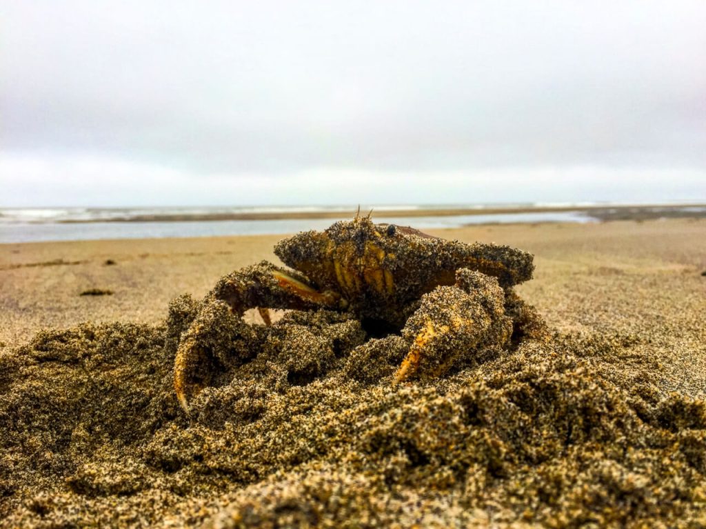

🦀 One of the most unique aspects of the Oregon Coast Trail is the near-constant access to tidal ecosystems.
The more joy you find experiencing all the beach has to offer, the happier you’ll be on this trail.
You’ll already plan your day around low tide times, so make sure you add extra time to explore them a bit. You can find everything from sea stars to hermit crabs to crabs to my personal favorite: the gooseneck barnacle!
🦅 You’ll often find Great Blue Herons searching the tide pools as well as Bald Eagles and even Puffins near Haystack Rock!
📲 I use a variety of apps on my phone to satisfy my curiosity. I use Seek, iNaturalist, Merlin Bird ID, and Bird Net. All four apps are FREE.
Final Thoughts
I LOVE the Oregon Coast Trail for the amazing scenery, tidal ecosystems, easy-to-access towns, and the experience of a different thru-hike. 🏖️
I found the Oregon Coast Trail challenging in how much planning I needed to do for such a short thru-hike. Between planning legal camping and the tide tables, it just felt like extra planning.
⛺️ The actual terrain was fairly easy. I found the most challenging terrain to be the times when we hiked through high tide and had to walk on the bigger slants with looser sand. Having one leg slightly higher than the other for miles made me take more frequent breaks.
If you love beach walking, coastal communities, and hiking, you’ll love this trail! Bookmark this page for your future planning needs.
As always, if you have questions, drop them below!

