Stats
👣 Miles: 15.72
📈 Elevation Gain: 2,064 ft
📉 Elevation Loss: 2,694 ft
Overall Weather: Sunny, Breezy, Warm in the Sun Without Wind
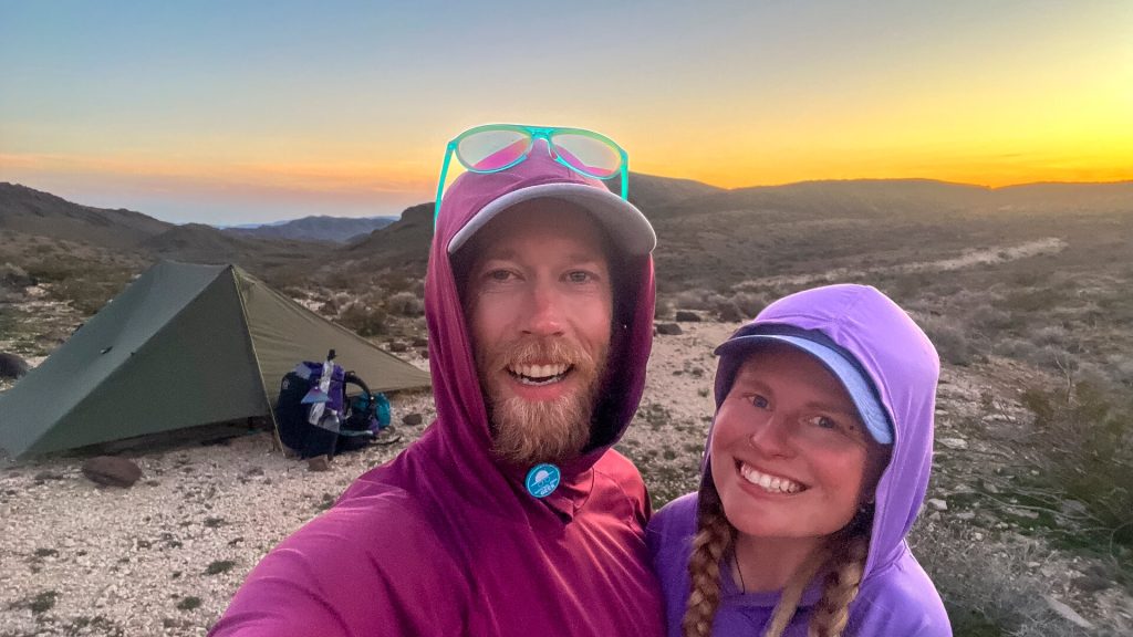
Chilly Campsite
We picked a very cool campsite last night, but it was pretty chilly next to the large rocks.
I remember hearing an owl hooting very close to us before passing out hard. A calm wind to no wind night afforded us what we needed: sleep. We slept long and hard after the nearly sleepless wind the night before.
We took a lazy morning and waited for the sun to rise. It never reached our tent, but we waited until it would be easy to walk into its warmth.
The “Memorable” Rocks
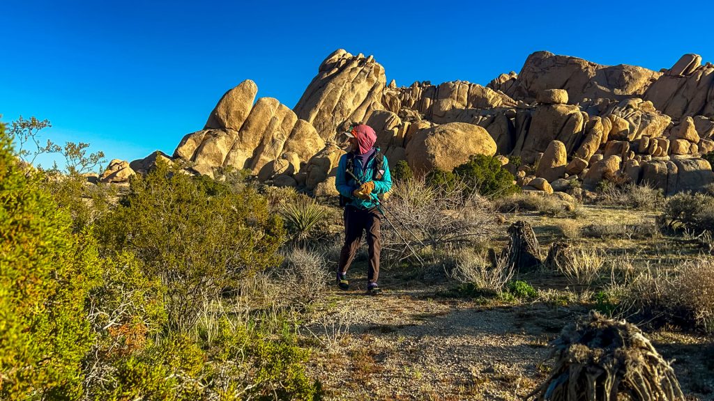
Sometimes, BT hints at things in comments on waypoints. The next point only mentioned that the next section would be “memorable.”
It was indeed fun, and we were happy that we waited for the sun to creep over the rocks.
We hopped around on large boulders that were largely grippy.
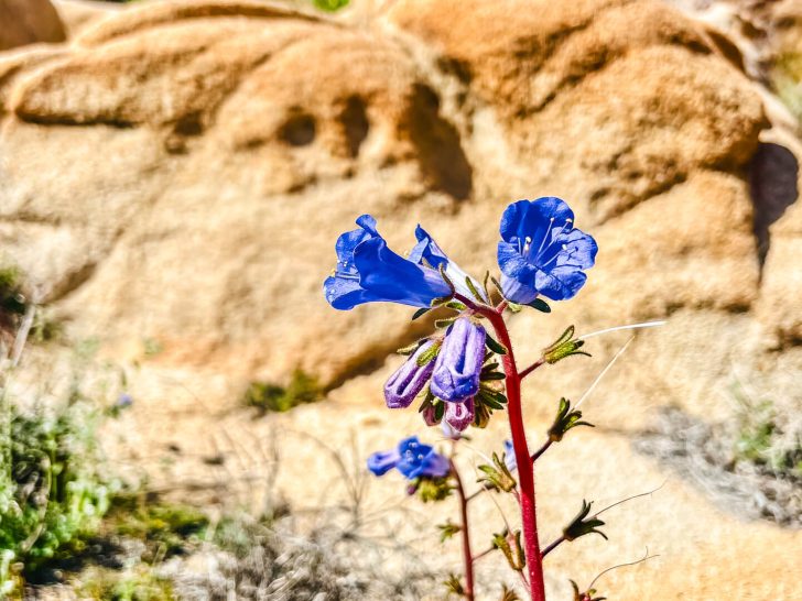
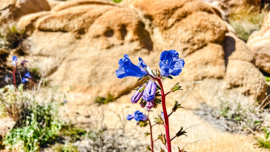
There, we saw a new array of blooming flowers! The desert bluebells were my favorite. We’d seen them before, but much smaller. These were out and ready for spring.
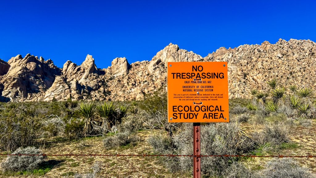
Some “Follow the Fence”
Our day largely consisted of the usual mix of cross-country and very old 4WD “roads” forced into being trails by a wilderness designation. Enough plants grew in between the old tire tracks that it looked more like two parallel trails.
For several miles, we used the swath that had been cut out when building a fence around an ecological research center.
Basically, the California Desert Protection Act of 1994 gave the University of California a section of land to use for research. A sign said they had over 170 ecological studies happening on the land, some of which were long-term 20+ year projects.
Some of their projects apparently included studying desert crust formation like cryptobiotic soil. Others included examining the effects of livestock and grazing (likely using this as a control.)
Basically, we couldn’t cross this area and had to follow around their fence line. We’re no strangers to “follow the fence on x side” from the GET. This is a common comment when navigating the checkerboard areas of private and public land.
More Balloons
We picked up another four balloons today. One was an entire blue Spider-Man, another was the same blue star we’d been finding, one was a heart shape, and the last was a happy birthday balloon.
🚨 Stop. Releasing. Helium. Balloons. 🚨
On this trail, we’ve seen the highest numbers of them in the Mojave Preserve. Based on wind directions, they’re likely coming from the shorter distance of Essex or the longer distance of Yucca Valley or the LA suburbs.
Wildflowers
As we hike closer and closer to spring, the wildflowers are starting to grow.
We were surprised to see quite a few wildflowers starting to grow at the higher desert elevations. Well, at least high for winter standards – ha!
Camp
We stopped for the night in a wide, low pass. Ironically, it was one of the lower elevations we’ve camped at in days. Likely, not since leaving the expensive Fenner gas station.
This section has been more sustained elevation than the rest of the route so far. While not high elevation for most of the year, it’s high enough that it’s been colder. The wind had more of a bite to it. The air wasn’t humid. Basically, it’s high for winter.
The whole day, I felt like we should drop in elevation, and it was only toward the end of the day that we actually did. I’m already a bit warmer.
Instead of an owl, fall asleep to the hum of i40 off in the distance.