Stats
👣 Miles: 19.20
📈 Elevation Gain: 3,570 ft
📉 Elevation Loss: 3,530 ft
Overall Weather: Sunny, Cold ➡️ Warmish, Wind Slowly Picking Up
The Road Trip Back
While we felt disappointed to turn around within 10 miles of finishing our route, it made sense safety-wise.
Could we have pushed and tried it? Yes. Were there multiple ways it could go wrong? Yes. Do we regret it? No.
We got a ride from Karma’s Mom and her Husband in their RV all the way back to where we stored our van in Tuscon. It was a straight-through drive, and we made it just before the storage facility closed.
Since we did a fantastic job cleaning the van this time, it was fairly easy to get it up and running again. We had to remove all of our critter traps (no mice!!!) and turn our electrical system back on (lithium batteries were still full…win!)
After we filled our water tank, we found a camping spot relatively close to town for the van and Harvey’s RV. Karma’s Mom fed us great Mom home-cooked food, and we told stories all evening.
The next day, we did a large chore run to get our propane tank filled, groceries stocked, and all the odds and ends.
We camped together for a few days before we parted ways. They went off to find a spot for the eclipse, and we went on a mission to unbury all of our cache buckets.
As we road-tripped around, grabbing all of our cache buckets, we continually scanned the weather to find our perfect window.
12 Days Later
Eventually, we spotted the best weather window that worked within our accelerated time frame for getting back to work.
It seemed that the area around Big Bear was just about to get hammered with another storm over the weekend that would likely drop quite a bit of snow again.
We camped within 20 minutes of our start and packed our backpacks with the essentials only.
Bright and Early Start
We got up before sunrise and drove to the trailhead. Just as planned, we parked right at sunrise and locked up the van.
It was definitely cold at 8,500 ft in late March!
We hiked a mile up the fire road to cross the PCT (our end point!). There, we saw a PCT hiker tent with their stuff hanging all over 3 trees around them and their shoes sideways next to their tent. Classic!
The fire road increased in snow as we hiked up, but this time, we had our seal skinz socks! Mwhahaha!
I used both the Open Snow and GaiaGPS snow depth layers to see that we’d likely be in snow in various stages of melting for about 4-5 miles each way. Since the route at the higher elevation contoured the mountain on the north side, it would hold snow for longer.
Onto the Snow
We purposely left early not only for the mileage but to stay on top of the snow as long as possible.
Because the route used a closed fire road, we were not as concerned with steep snow drifts as we would be on a trail.
During the first 4.5 miles of snow walking, we easily stayed above the snow for most of our steps. We sunk in a few times, but nothing crazy happened.
We woke up a large number of Turkey Vultures and sent them spiraling into the thermals. Pausing, we counted over 70 of them!
Down to Where We Left Off
Finally, the route curved onto south-facing switchbacks, and we were out of the snow for now!
At that point, we stashed a liter of water each in the bushes to get us through that same 4.5 miles on the way back. We set a GPS pin just in case. Why carry it down and up the main elevation just to only need it for the 4.5 miles?
From there, we wound down and down until we ended up in the wash. We put some music on and zoned out as we cruised downhill to where we on-trail zeroed.
Ironically, about 3/4 of a mile from our last campsite on trail, we found a stream with flowing water. This canyon was known for being completely dry, so it’s hard to say if it was running 12 days earlier or not. The stream came right out of the snow, so it was probably just melt water.
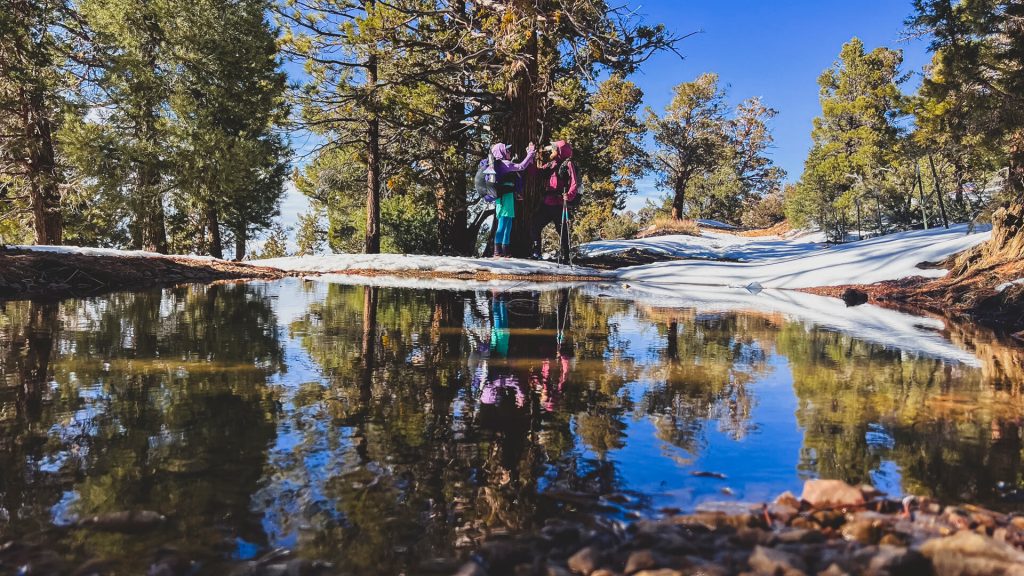
Tagging Our Campsite
Finally, we reached our campsite and connected our steps! It felt great, but also like the reverse of a mountain…now we had to hike back up and out to actually finish! 😂
Neither of us wanted to stay there for long, so we hiked back up to the stream and ate lunch.
Hiking Back Up to the Van
For the hike up, we both listened to music as we plugged uphill. The hike up was fairly uneventful.
We found our water bottles and continued up toward the snow. It was really nice doing that main elevation with 2.2 pounds less!
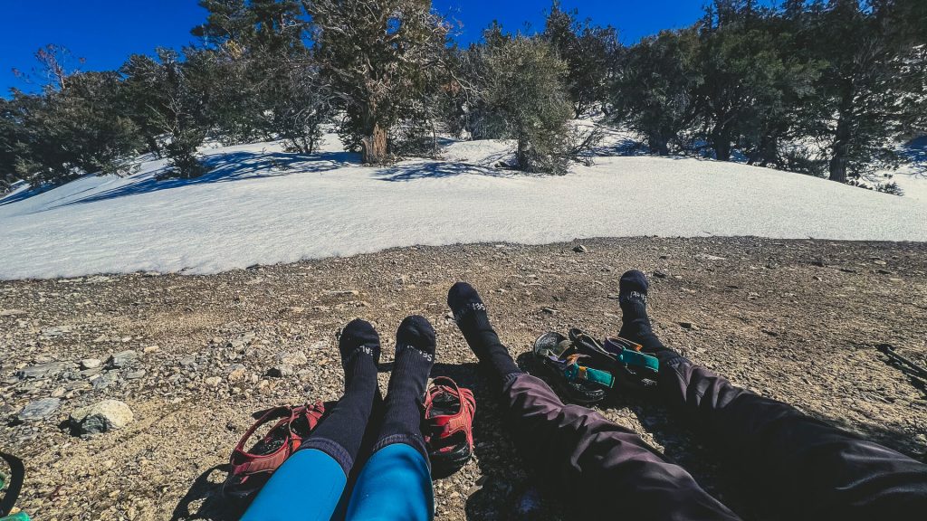
Right before the snow, we paused and put our seal skinz socks back on to make our feet more comfortable. Without them, the snow tends to ball on the socks. It still balls a little, but in our experience, significantly less.
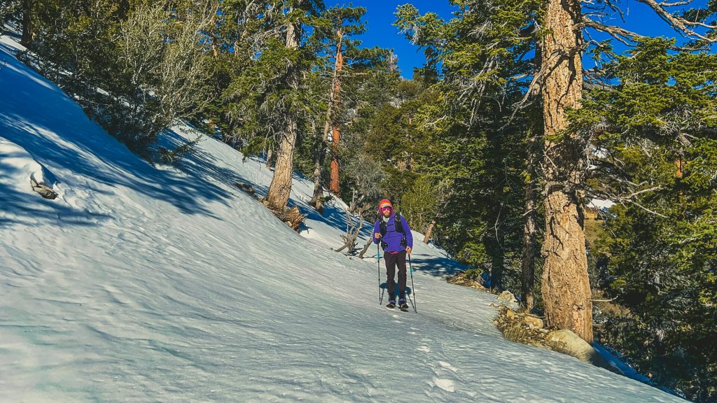
Post-Holing Time!
When we returned to the snow, it was now in the sun. To give you an idea of how much had melted in the past few hours, almost all of our footprints were gone.
We kept listening as we started to post-hole. The sun had melted the upper layers of snow, so instead of mostly cruising on top, each step sunk into it.
Most of the time, we only sunk in about 6 inches, but occasionally, it was a SUPRISE…and we sank in up to our knees.
Basically, we put our heads down and made slow, steady progress back through the snow.
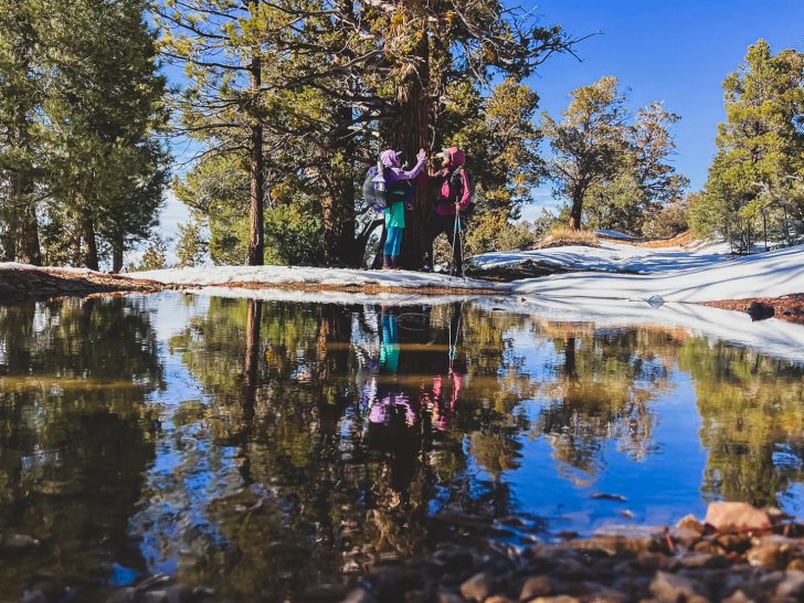
We got to the PCT, and there was a giant snow melt puddle. We did a little dance, took some pictures with some trees, and walked the mile back to our van.
The End
Doing the extra out and back added a few extra miles but seemed like the most logical way to connect our footsteps.
Now, Karma and I have both created a giant loop of our past footsteps around the Western US. This was the final piece to connect the PCT ➡️ PNT ➡️ CDT ➡️ GET ➡️ AZT ➡️ DWTH ➡️ PCT. 🙌