Stats
👣 Miles: 17.90
📈 Elevation Gain: 748 ft
📉 Elevation Loss: 994 ft
Overall Weather: Cool, Windy, Overcast ➡️ Warm, Windy, Sunny
A Cache Kinda Morning
We took some time at our cache before leaving. Sorting a cache in a tent with two people takes a bit of patience.
Not only is there not a ton of space, but everything is exploded. Since we will return to get the bucket, we will re-bury it with our trash inside to properly throw away later.
For breakfast, we ate our cache meal (Indian food packets) with a Dr. Pepper Cream Soda.
Once we had filled all our water bottles and drank our fill, we assessed how much we had left.
It was just enough water to rinse out a pair of socks each, a pair of underwear each, and the Kula Cloth.
Old Highway 66
We camped near Old Highway 66 and could hear the train periodically throughout the night.
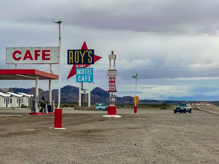
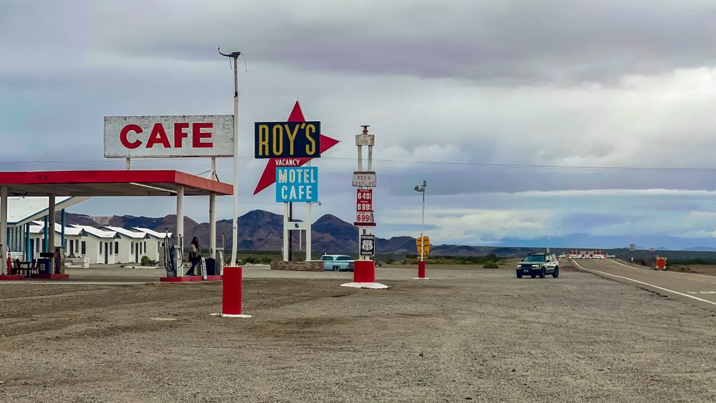
On our way to cache here, we popped into Roy’s Motel and Cafe—which is actually a gas station with a small convenience store (no rooms or meals). While the employees were nice, their selection was so-so.
Honestly, if it were a hot day, I would have gladly paid for an overpriced cold soda. But it was cool and windy.
Instead, we took a few pictures of their sign. It’s in the movie Kalifornia (yes, with a K) and The Hitcher.
The Amboy Crater
Strolling alongside Route 66, I got a trucker to honk, and I saw him laughing as he did it.
We found we could easily avoid walking on the pavement here by walking next to it.
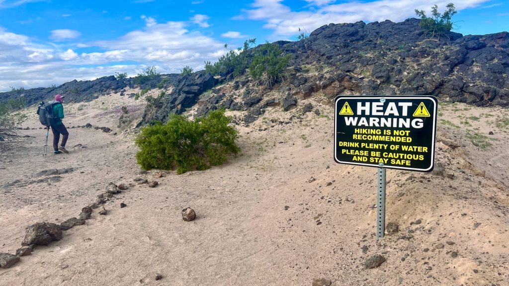
This took us to the Amboy Crater. Apparently, it’s one of the more recent volcanic locations in the US (at 6,000 years old).
We opted not to climb it since we knew we’d then have the pleasure of hiking cross-country for 4 more miles across the lava flow.
The Lava Flow
We knew we lucked out on the weather here. Lava rock heats up quickly and then radiates that heat back up.
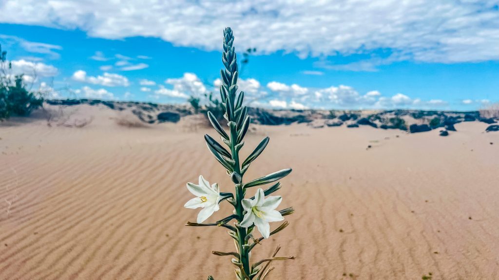
However, it was overcast until about 11 am. We made it most of the way across the lava flow before the rocks started radiating heat up at us.
In the meantime, we found some desert lilies for the first time and some pink sand verbena flowers.
The Dry Lake Bed
I’ll admit, when I saw “dry lake bed” in the notes, I thought more about the drivable ones nearby full of van campers. You know, the ones with hard surfaces that are easy to walk on.
That was not this one.
Almost every step sank in. I felt like I was working harder than climbing uphill just walking across that lake bed. My watch confirmed my suspicions.
By this time, the sun had warmed the area, and it was getting hotter.
We had to listen for the second half of it while we slogged through, and I finished another audiobook.
Our Water Cache
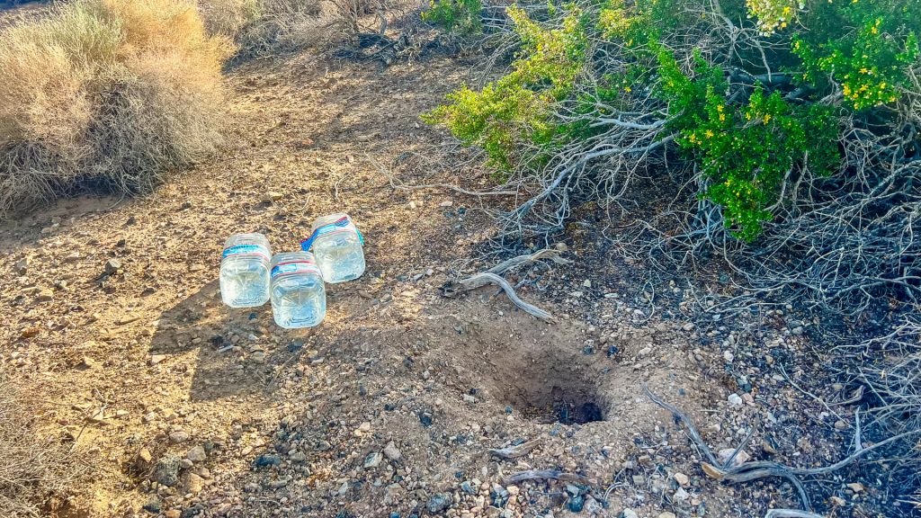
This section had a 32-mile water gap. That didn’t sound fun, and we were caching anyway, so we buried some water about halfway through. Thanks, BT, for that heads-up!
This one only had water gallons, no bucket.
We had gone decently off the road and off the route and dug them in.
However, when we got there, all 3 gallons lay out of the hole on their sides. 🫣
Luckily, all three remained sealed and intact!
We surmised that maybe an animal dug around them, making them visible, and a human got curious and pulled them out. Then, they couldn’t get them back in the hole when they realized it was a water cache with names on it. 🤷🏼♀️
That was the first time that has happened to us!
We drank plenty of water, filled our bottles, and broke down the jugs with a knife to fit them into a gallon ziplock and pack out all the plastic here.
Finding Camp
We continued following the route until we realized where we were headed had no good camping options.
The ground was soft, there were no rocks, and the creosote bushes were barely knee-high.
A breeze had kicked up, and there was a slight possibility of a blurb of rain.
We needed a larger creosote for a wind block. (Whatever small help it could offer is sometimes significant.)
Veering well off route just after sunset, we found an acceptable bunch of taller creosote and a small berm to help with the wind.
While not a picturesque campsite, it seems to do the job. Sometimes, on a thru-hike, your campsites get based more on what mileage breaks up the food and water carries rather than on scenery. 🤷🏼♀️